


Data to Decisions CRC and a team from the University of South Australia have created two new visualisations for the Department of Defence and other government agencies.
The new visualisations can understand the relationship between moving entities.
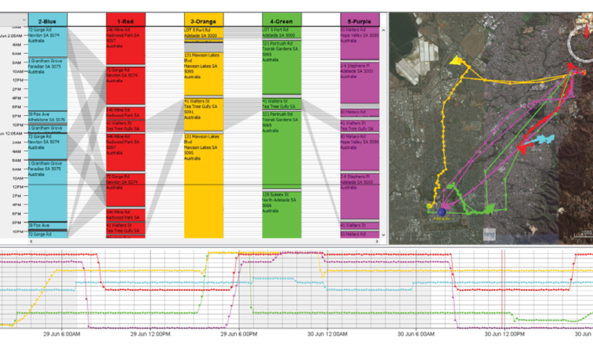
The project’s aim was to visualise the convergence, colocation and divergence of entities in geospatial data sets, over large periods of time. This includes one-off or repeated visits to different locations and periods where each entity is idle or active. The project also aimed to identify basic or routine patterns of behaviour.
The results of the project will allow defence and policing organisations to more easily identify entities, locations and time-periods of interest from within ever-growing data sets and thus reduce the workload and interaction with data by analysts.
The project was undertaken by a team of four UniSA researchers, including Dr James Walsh (lead researcher), Dr Ross Smith and Dr Jo Zucco, and was run by project lead Professor Bruce Thomas.
“Working with several government agencies, we developed innovated solutions to solve visualisation problems for understanding complex relationships between entities moving not only in space but in time. Australia is faced with ever changing challenges when understanding complex big data, and therefore the specialised tools we developed will help with these challenges” said Professor Thomas.

D2D CRC has licensed the technology to Esri Australia, the nation's leading geographic information systems technology and services provider, to further develop it for the Department of Defence.
